
| 3-day forecast 10-day forecast | Smoke forecast | Avy forecast | |||
| Photo | Trail Name | Hike Date | Trail Status | Comment | Submitted By |
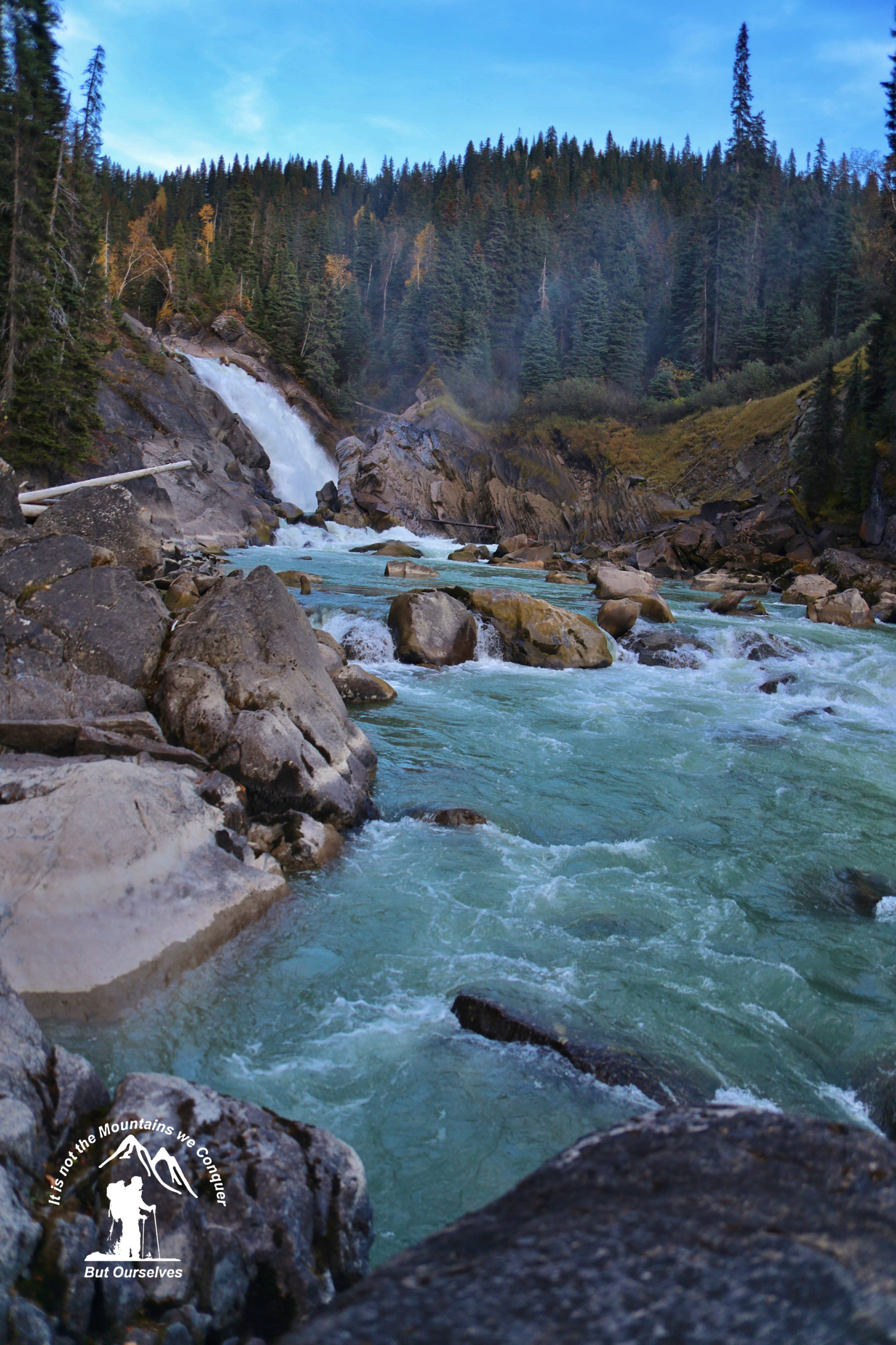
 | Herrick Falls in Northern BC | 2026-Jun-03 | Dry | Trail is mostly gone but wasn't too far to get to the falls, we put a ribbon on the main road showing the best spot to hike down to the falls to minimize bushwacking | Mark Vejvoda |
Description:
The Herrick Falls are a ways up the Herrick Creek. Herrick Creek is the major tributary of the McGregor and is similar in size to the McGregor at their confluence. It has a moderate gradient (2 m/km) from its mouth to Spakwaniko Creek. This reach has diverse habitats, including high-quality holding pools. From Spakwaniko Creek up to and including the 18-meter Herrick Falls at km 45.5, the average gradient of Herrick Creek is 12 m/km. There is lower habitat diversity in this reach due to the preponderance of riffles. This reach would be the upstream migrational limit for Chinook salmon.
Stats:
Distance: 0.90 km
Elevation Gain: 53 m
Elevation Loss: 16 m
Elevation Max: 790 m
Elevation Min: 736 m
Photos:


Videos:
June 2026: