
| 3-day forecast 10-day forecast | Smoke forecast | Avy forecast | |||
| Photo | Trail Name | Hike Date | Trail Status | Comment | Submitted By |
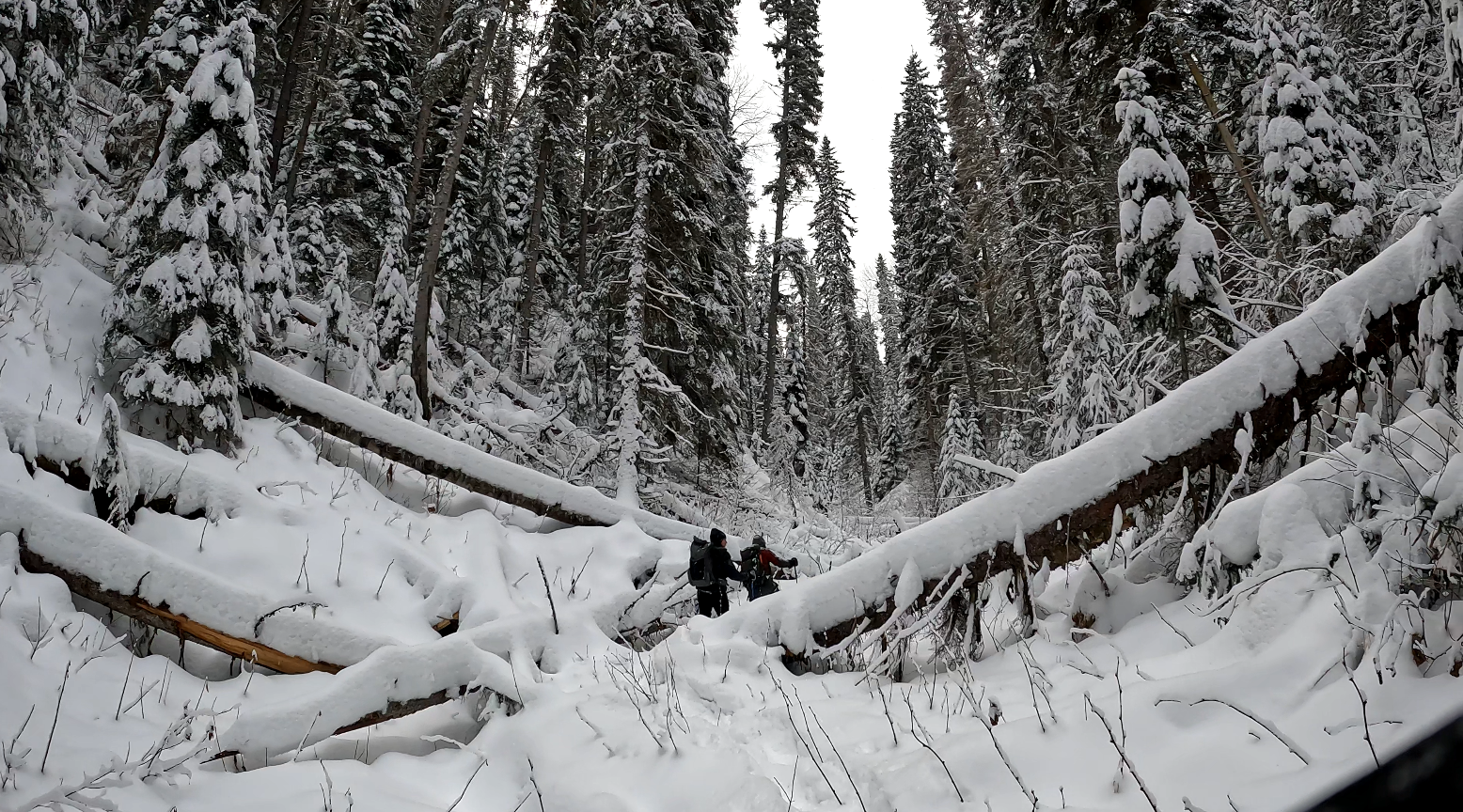
| Garvins Canyon Trail in Pilot Mountain BC | 2026-Jan-10 | Snowshoe Packed | Great day at Garvin Canyon!! Mother natures winter wonderland | ||
 | Garvins Canyon Trail in Pilot Mountain BC | 2025-Dec-27 | Snowshoe Packed | We snowshoe packed the trail into Garvins Canyon but made an extended 6 km loop by heading back to the trail via the south trail loop | Mark Vejvoda |
 | Garvins Canyon Trail in Pilot Mountain BC | 2025-Oct-25 | Wet | Bushwhacked from Pilot Mt to Nechako River via Garvins Canyon. Conditions were very bad, unlimited deadfall, thick brush, wetness and definitely not recommended! | Mark Vejvoda |
Description:
This hike/snowshoe is a moderate challenge, depending mostly on the distance you travel.
Garvins Canyon Map
Stats:
Directions to trail: here
GPX track: here
Distance: 4.39 km
Duration: 1 hours 6 minutes
Elevation Gain: 50 m
Elevation Loss: 64 m
Elevation Max: 794 m
Elevation Min: 720 m
GPX track: here
Distance: 4.39 km
Duration: 1 hours 6 minutes
Elevation Gain: 50 m
Elevation Loss: 64 m
Elevation Max: 794 m
Elevation Min: 720 m
History:
Click here to read about the history of this trail
Photos:


Videos:
December 2025:
Oct 2025:
Jan 2025:
Jan 2024: