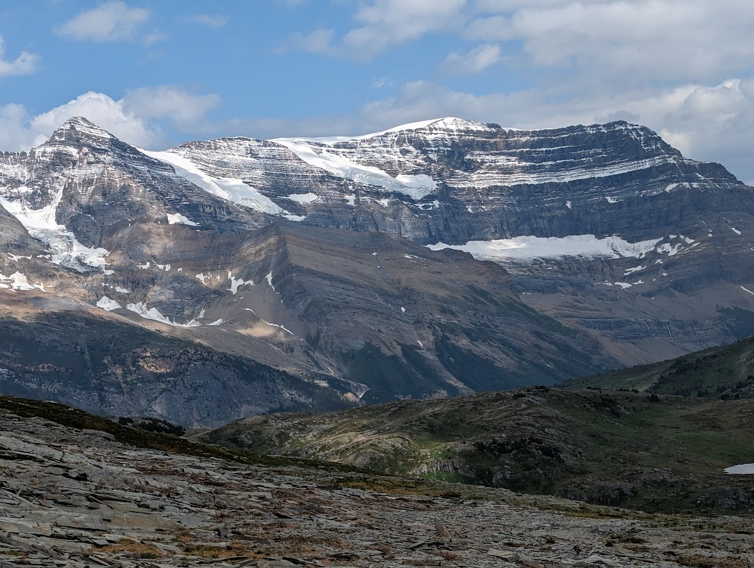
This spectacular hike climbs 7.3km starting on the Holmes forest service road (near the 43km mark) and passes through brushy willows, open meadows, muddy sections following a river and ultimately leading into some of the most beautiful backcountry you will see in Northern BC (think Mt Robson vibes as this area is due west of Mt Robson Park). There is no cell connection at all in this remote area and water sources are abundant most of the way up the trail. This trail had flagging but areas of the trail disappeared into the river crossings making it hard to find at times and requiring some route-finding skills. The views on the ridge above Blueberry Lake are outstanding and moving eastward reveals amazing glacier views and numerous lakes with 360-degree mountain views. This is one of my favorite hikes in the region and it offers so much reward for the effort required. While the track below shows almost 20 km the hike to Blueberry and back could be a shorter 15km round trip if you only go to the lake and return.
Directions to trailhead: in 2 parts because Google Maps won’t route the best road to the trailhead:
Part 1 (highway): here
Part 2 (logging roads): here
August 2023 multiday trip:
Day 1:
This adventure started with our recon (see the video back on July 5, 2023) of Blueberry Lake Trail near McBride in Northern BC. On day 1 of this multi-day hike we started at the Blueberry Pass Trailhead at the 43 km point on the Holmes Forest Service Road.
We made our way with 40 lb packs to Blueberry Lake, then up the GDT west to the Jackpine Valley Flats, then onward part way down the Jackpine Pass to our base camp. The area we chose had shelter from the wind, and a close water source, and was central to our upcoming goals both down and back up the Jackpine pass that we were hoping to explore.
There is no cell connection at all in this remote area and water sources are abundant except for higher alpine sections where you may or may not encounter lakes. This trail had flagging but areas of the trail disappear into the river crossings making it hard to find at times requiring route-finding skills.
Difficulty: Moderate/Strenuous
Distance: 13.4 km
Ascent: 1106 meters
Max elevation: 2084 meters
Moving Time: 5 hours 20 minutes
Total Time: 7 hours 23 minutes
GaiGPS Track: here
Day 2:
On day 2 of this multi-day hike, we started at our Jackpine Pass campsite at the mid-way down the Jackpine Pass. We made our way west on the GDT towards the Resthaven Glacier.
After crossing the river at the bottom of the Jackpine River on the bottom of the pass we started our bushwack towards the Resthaven near Saurian Mt. After climbing into the alpine we could see that we were not comfortable climbing the craggy peaks that would get us to the final few hundred meters to see the Resthaven Glacier so we turned back and followed the creek down to the GDT and followed it east back to our campsite.
There is no cell connection at all in this remote area and water sources are abundant except for higher alpine sections where you may or may not encounter lakes. This trail had flagging but areas of the trail disappear into the river crossings making it hard to find at times requiring route-finding skills.
Difficulty: Strenuous
Distance: 14.5 km
Ascent: 1047 meters
Max elevation: 2296 meters
Moving Time: 6 hours 35 minutes
Total Time: 9 hours 8 minutes
GaiGPS Track: here
Day 4:
On day 4 of this multi-day hike, we hiked out from the Jackpine Pass to the Blueberry Pass Trailhead.
There is no cell connection at all in this remote area and water sources are abundant except for higher alpine sections where you may or may not encounter lakes. This trail had flagging but areas of the trail disappear into the river crossings making it hard to find at times requiring route-finding skills.
Difficulty: Moderate
Distance: 12.8 km
Ascent: 318 meters
Max elevation: 2083 meters
Moving Time: 5 hours 0 minutes
Total Time: 6 hours 27 minutes
GaiGPS Track: here
For the next 3-4 km we explored this route in all of its glory until we stopped at the bottom of Mt Holmes and had lunch. Shortly after lunch we turned east and headed back to our campsite exploring a different route back through giant boulders. Eventually, we connected with the GDT and followed it north back to our campsite.
There is no cell connection at all in this remote area and water sources are abundant except for higher alpine sections where you may or may not encounter lakes. This trail had flagging but areas of the trail disappear into the river crossings making it hard to find at times requiring route-finding skills.
Difficulty: Strenuous
Distance: 17.5 km
Ascent: 1021 meters
Max elevation: 2415 meters
Moving Time: 8 hours 12 minutes
Total Time: 10 hours 6 minutes
GaiGPS Track: here
July 2023:
Difficulty: Moderate/Strenuous
Distance: 19.6 km
Ascent: 1209 meters
Max elevation: 2216 meters
Moving Time: 7 hours 55 minutes
Total Time: 9 hours 36 minutes
GaiGPS Track: here
Photos:


Videos:
Drive down the Holmes forest road to the trailhead (July 2023):
August 2023 multi-day trip:
Tesla Prince:
Day 1:
Day 2:
Day 3:
Day 4:
Trekking with Taz:
July 4, 2023 recon hike:


Beautiful Mark! Thanks for sharing as always