
| 3-day forecast 10-day forecast | Smoke forecast | Avy forecast | |||
| Photo | Trail Name | Hike Date | Trail Status | Comment | Submitted By |
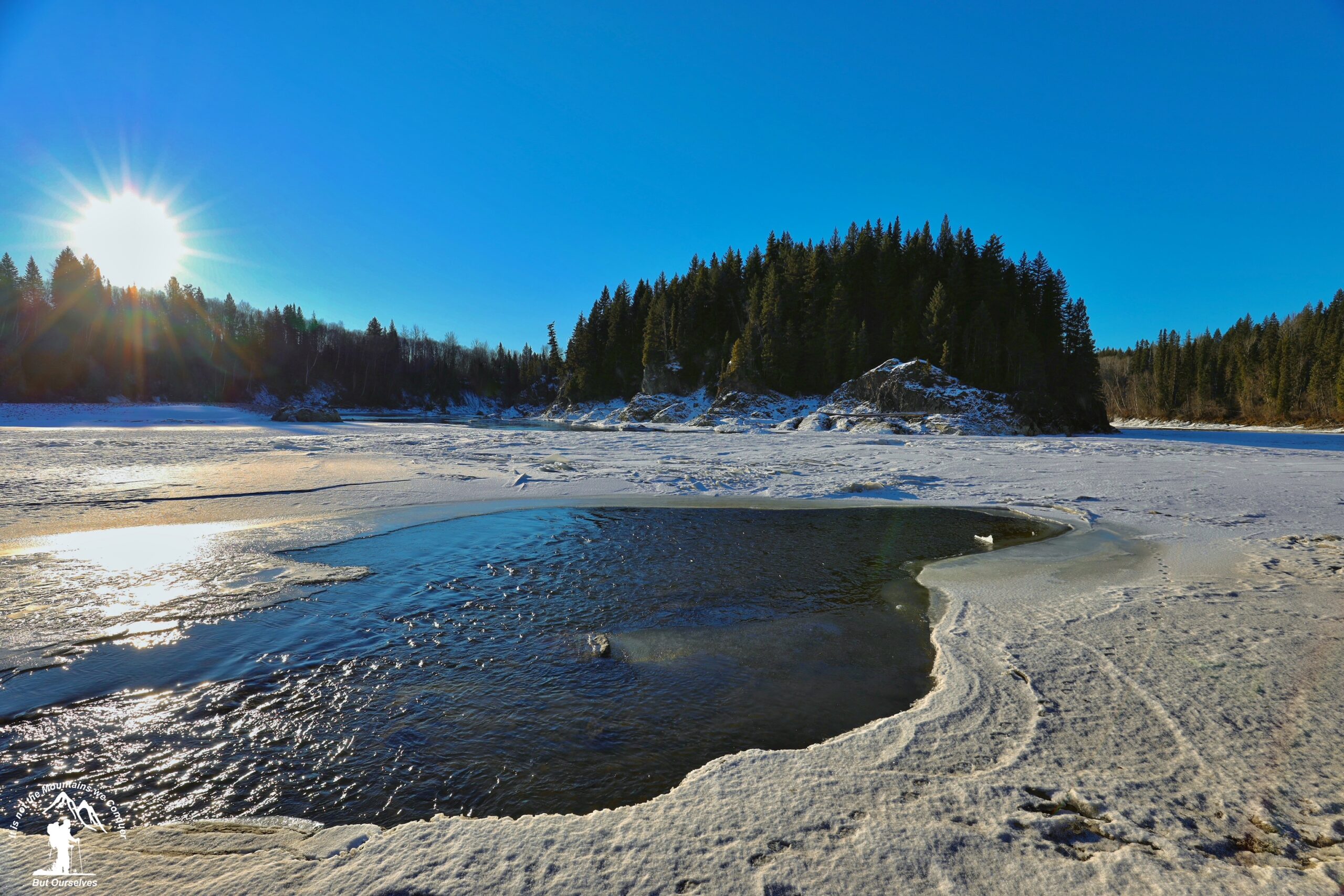
 | Fort George Canyon in Northern BC | 2025-Nov-12 | Variable | We hiked to the Fraser and all the way to the steam boat pin anchor and conditions were pretty dry overall. The road had the usual ruts and water holes but nothing out of the ordinary... no snow. | Mark Vejvoda |
| Fort George Canyon in Northern BC | 2025-Jul-06 | Dry | Decided to explore the Fort George Canyon trail today. It was an interesting trail that kept you on your toes, very overgrown in spots so some sections it was hard to see the trail. Some muddy sections to maneuver around, lots of mosquitoes looking for a tasty snack! The section down to the river is a little steep with loose rocks, went a bit further down the trail to see what other views were offered. Overall I enjoyed the hike:) 10.7kms round trip for us. | ||
 | Fort George Canyon in Northern BC | 2025-May-02 | Unknown | THE ROAD INTO THE TRAILHEAD HAS A VERY WET SECTION WHEN YOU FIRST START DOWN THE ROAD BUT IT HASA VERY SOLID ROCK BASE AND ISNT AN ISSUE. THE ROAD IS A LITTLE ROUGH BUT NOTHING SERIOUS. THE TRAIL ITSELF IS IN GREAT SHAPE AND MOST WET AREAS NOW HAVE WALKWAYS THANKS TO THE CALEDONIA RAMBLERS. ONE TREE CAME DOWN WHILE I WAS IN THERE BUT ALL OTHER WINDFALL WAS RECENTLY CLEARED BY THE CALEDONIA RAMBLERS AS WELL SO THANKYOU TO THEM. | TAZ |
This small 178-hectare park consists of two parcels on either side of the Fraser River south of the city of Prince George. Public recreation opportunities and trail access are available on the west side of the river. The park is day-use only. Up until 1914 the Fraser River was the highway in and out of this part of British Columbia and Fort George Canyon was one of the obstacles that sternwheelers had to navigate. Rapid and dangerous, this canyon abounds in whirlpools and massive, jagged rocks close to the surface.
The park protects the historic winch site used by paddle-wheeled boats in the early 1900s and related portage, a native fishing site, and a popular hiking trail.
GPX track: here
Distance: 14.22 km
Elevation Gain: 336 m
Elevation Loss: 328 m
Elevation Max: 823 m
Elevation Min: 567 m
Photos:


Videos:
Nov 2025:
April 2024: