
| 3-day forecast 10-day forecast | Smoke forecast | Avy forecast | |||
| Photo | Trail Name | Hike Date | Trail Status | Comment | Submitted By |
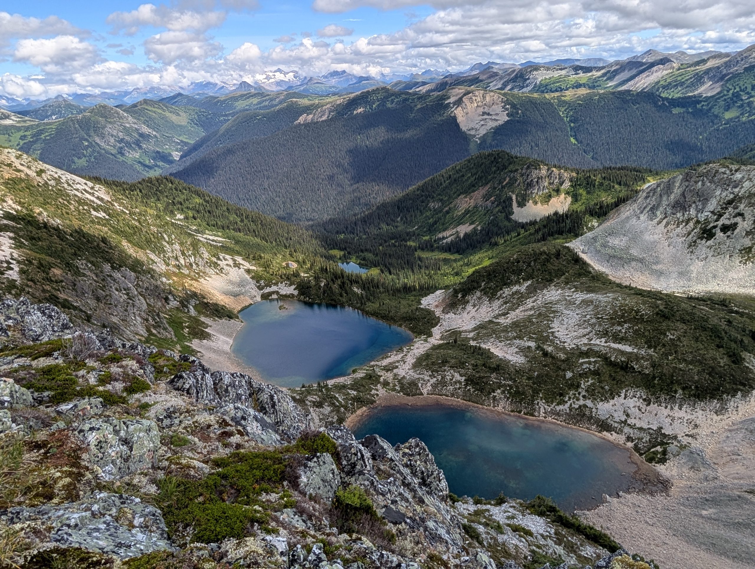
 | Humbug Ridge near Walker Creek Forest Service Road | 2025-Aug-14 | Variable | The P.O.B. road was wet and muddy, requires good 4x4 to get to the trailhead. The trail was brushy for the first 2 km but then as it turns up the mountainside is in great shape. Views on the ridgelines are excellent with opportunities to explore or camp for days in several directions. | Mark Vejvoda |
This trail is located in the Walker Creek Forest Service Road area. Drive east from Prince George, BC, for about 1.5 hours and turn north onto the Walker Forest Service Road. Drive about 7 km until you read a turnoff on the right with signs and an incline leading up towards the Humbug Trailhead. This turnoff is called the P.O.B. (proper old bitch) road and requires a 4×4 to get to the trailhead, as several sections have very deep and muddy ruts. Others without 4×4 have been stuck on this road, so take note! Drive 7.3 km until you see a side road to the left, ribbons, and a trailhead sign indicate the start of the trail.
Difficulty level: Strenuous
Drive from Prince George, BC to Walker Creek Forest Service Road: here
Drive to the trailhead from Hwy 16 GPX track: here
Distance: 18.17 km
Duration: 4 hours 9 minutes
Elevation Gain: 1,343 m
Elevation Loss: 1,308 m
Elevation Max: 2,067 m
Elevation Min: 786 m
Photos:


Videos:
August 2025: