

:
:
:
:
:
:
:
:
:
:
:
:
:
:
:
:
:
:
:
| 3-day forecast 10-day forecast | Smoke forecast | Avy forecast | |||
| Photo | Trail Name | Hike Date | Trail Status | Comment | Submitted By |
 | Kakwa Provincial Park in Northern BC | 2025-Aug-30 | Variable | Backpacked into a place called Shangri-la in Kakwa Provincial Park, a true gem. The drive down the walker was as per usual and the last 3 km were very bad.. 4x4 only. | Mark Vejvoda |
 | Kakwa Provincial Park in Northern BC | 2025-Jul-27 | Variable | Hiked into Kakwa Lake Cabin, then to Jarvis Lakes Cabin and onto Moonias Lake, trail was good to the turnoff to Jarvis and then hard to find off and on. Weather was decent during our week and creek crossings were the lowest i've seen in years, especially Buchanan. | Mark Vejvoda |
 | Kakwa Provincial Park in Northern BC | 2025-Jul-13 | Muddy | We drove down the Walker Forest Service Road to the Bastille Bridge to pickup a GDT hiker who was injured. The drive was very brushy and the last several km were very rough and muddy. The hiker returned on July 19, 2025 and was able to cross the Buchanan Creek waist level deep (6 foot tall person) without issue. | Mark Vejvoda |
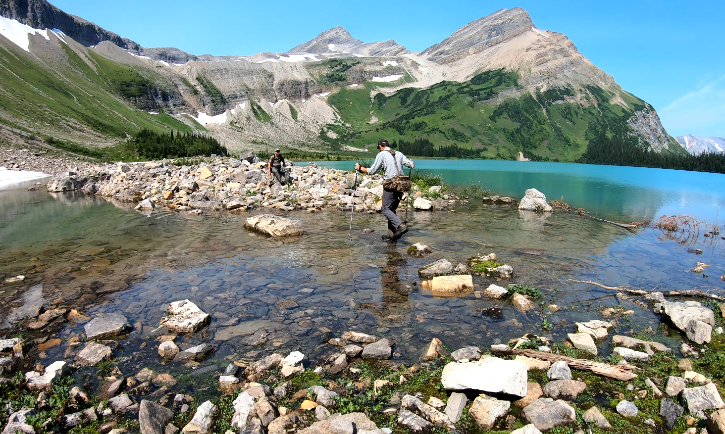
Kakwa Provincial Park is considered ‘what Jasper Park was 100 years ago’ in that it is a raw, world-class backcountry. The Walker Creek Forest Service Road is the only way of entry into this BC Park from the BC side (there are alternatives on the Alberta side that may be worse depending on the year). The Great Divide Trail (GDT) ends its northern terminus at Kakwa Lake. This park has a guest cabin that can sleep 8 people comfortably, but more than that as the loft can squeeze in more depending on the size of the people.
*Note: For anyone using ‘Via Rail’ train, the mile marker for the Walker FSR–rail crossing is required if you are looking to book a pick up there and Via needs to know the exact mile marker. The Walker FSR crossing is mile 47.67. It’s always been called mile 48 by locals but that’s the exact location for Via.
Careful planning is required:
a) To successfully get to this park as the Walker Creek FSR can be in terrible shape (there are over 10 bridges to cross and these are in bad shape, in fact, the ministry has technically closed the road to traffic at around the 35 km mark, however, many have traveled beyond this point at their own risk). You may want to consider driving a quad or bicycle starting at the closed section, however, no motorized vehicles are allowed in park boundaries starting at the Buchanan Creek crossing (around 85 km).
b) have the best experience possible by pre-planning the trails and routes based on your experience level and time allotted.
BC Parks info for Kakwa: https://bcparks.ca/kakwa-park/
There is SO MUCH that could be discussed about this park, and I plan to update this space over time, but the videos and information below share the most current details as I understand them. This park is hard to get to, but offers an unreal, raw, backcountry experience with excellent trails to explore, glaciers, ice fields, lakes, fishing, etc.
Getting to Kakwa Provincial Park:
You should plan to drive a high-clearance 4×4 vehicle. Some have successfully driven with SUV or 2-wheel drive but I have rescued families with damaged/leaking oil pans so take note, you have been warned!
Gai GPS track of the drive from Hwy 16 down the Walker Creek Forest Service Road to the Bastille Bridge: here
after the Bastille Bridge, most people will need to hike (or mountain bike) the rest of the way. Mountain biking may be a challenge as the quad road between Bastille Creek and Buchanan Creek is VERY muddy, and you will be pushing your bike for many kilometers.
Gai GPS track of the hike or bike from the Bastille Bridge to Wishaw Lake: here
Gai GPS track of the hike or bike from Wishaw Lake to Kakwa Lake: here
Hiking in Kakwa:
Day hikes starting at the Kakwa Cabin on the lake:
GaiGPS track of the hike: Kakwa Lake to Babette Lake / Mt Ian Munroe summit: here
(a safer version of the Ian Munroe hike: here)
GaiGPS track of the hike: Kakwa Lake to Mt Ruth: here
GaiGPS track of the hike: Kakwa Lake to La Glace Lake: here
More hiking options can be found here, or message website admins for more details. We have tracks for everything we do, but we choose not to share the more remote trips as they require a lot more backcountry experience in order to stay safe.
Photos:


Kakwa history and research on the BC Park:
Videos:
August 2025 multiday backpacking trip to Shangri-la:
July 2025 multiday backpacking trip (Kakwa Lake Cabin, Jarvis Lakes Cabin, Moonias Lake):
August 2024 multiday backpacking trip (Sioux Lake, Flattop, Edgrain Lake, Mt Ida area) playlist:
Tesla Prince:
Trekking with Taz:
Day 1:
Day 2:
Day 3:
Days 4-5:
May 2024 multiday jetboat trip (Kitchi Creek, McGregor River) playlist:
September 2023 multiday trip (Kakwa Lake Cabin, Babette Lake area):
Tesla Prince playlist:
Walker Forest Service Road, driving from Hwy 16 to Bastille Creek:
July 2025:
May 2024:
August 2022:
August 2021:
Crossing the Buchanan Creek
Misc:
Babette Lake and Mt Ian Munroe Hike:
Mt Ruth hike:
La Glace Lake hike in Kakwa:
Preparing for a trip into Kakwa Provincial Park:
Biking from the Bastille Bridge to the Buchanan creek crossing:
July 2021:
Pommel Mountain Hike
June 2021:
May 2021:
September 2020: