
| 3-day forecast 10-day forecast | Smoke forecast | Avy forecast | |||
| Photo | Trail Name | Hike Date | Trail Status | Comment | Submitted By |
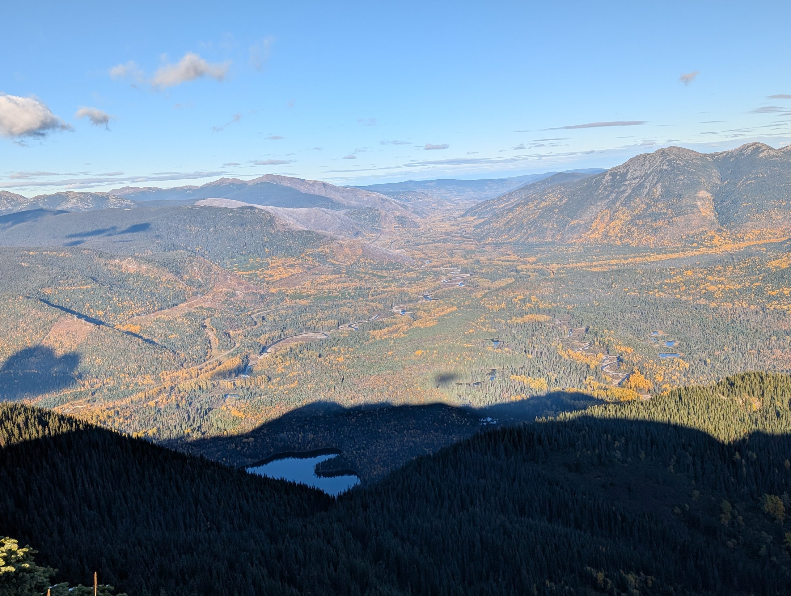
 | Solitude Mountain at Heart Lake in the Pine Pass | 2025-Oct-08 | Variable | The trail was somewhat dry but had some light snow near the top, clear skies and beautiful views. Found several caves up top | |
 | Solitude Mountain at Heart Lake in the Pine Pass | 2025-Oct-04 | Wet | This was a random exploration day, we had no idea what to expect and we discovered this trail goes all the way up to Solitude Mountain. The day was VERY wet with rain and snow higher up, but we percevered and found out that this is a great place to explore. There are caves and a lake to go fishing in. | Mark Vejvoda |
This trail is located at Heart Lake Campground in the Pine Pass, 2 hours north of Prince George, BC, across from Campsite #13. The trail has a trail sign on the east side of the road and is the only indication of a trail (GPS: 55.49605, -122.56379).
This location is accessible by car and offers great camping and fishing at the Heart Lake campgrounds in Lemoray Provincial Park
The well marked trail climbs steeply after the first 1 km point up to 2 stunning viewpoints overlooking Mountain Creek. After this, the trail becomes easy to lose, but it does have a decent trail leading all the way up to the Solitude Mountain area. It is highly recommended to use the GPX track we have on this page in order to avoid getting lost for those who have backcountry experience (we got lost a few times but navigated our way back using GPS).
Difficulty level: Strenuous
Hike GPX tracks
Trailhead to the first 2 viewpoints: here
Viewpoints up to Mt Solitude and back to main trail: here
Distance: 10.07 km
Duration: 2 hours 12 minutes
Elevation Gain: 957 m
Elevation Loss: 951 m
Elevation Max: 1,568 m
Elevation Min: 716 m
Photos:


Videos:
October 2025: