
| 3-day forecast 10-day forecast | Smoke forecast | Avy forecast | |||
| Photo | Trail Name | Hike Date | Trail Status | Comment | Submitted By |
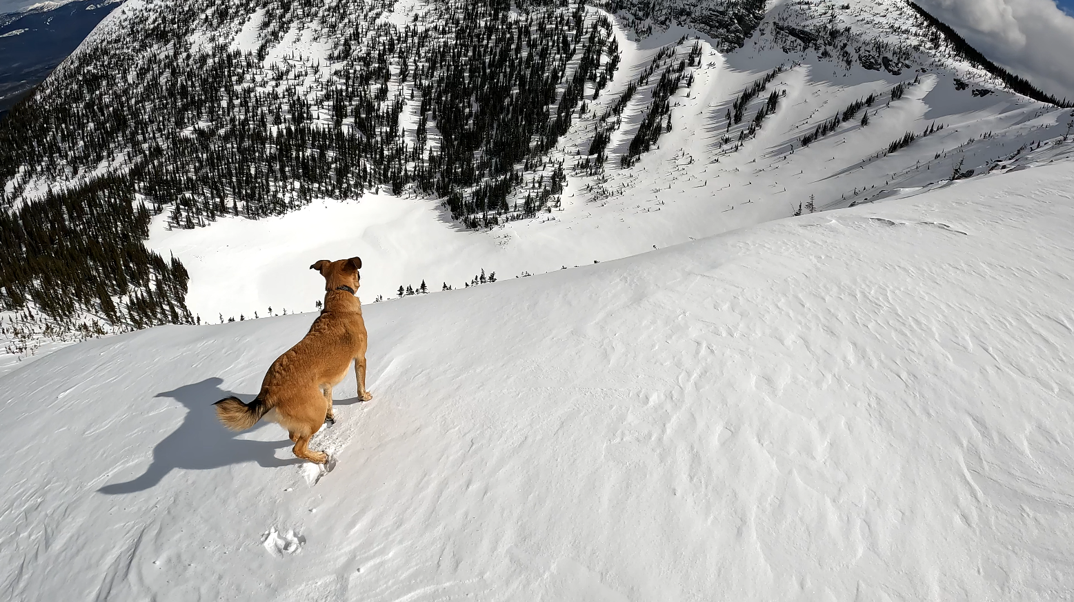
| Viking Ridge in Northern BC | 2026-Jan-11 | Snowshoe Packed | Willie Nelson (my dog) and I would like to thank the people (heroes) who blazed the trail at Viking Ridge. We appreciate your hard work! | ||
 | Viking Ridge in Northern BC | 2026-Jan-06 | Snowshoe Packed | An amazing and challenging day breaking trail snowshoeing Viking Ridge. | |
 | Viking Ridge in Northern BC | 2025-Nov-19 | Variable | No snowshoes required until the meadows, snow levels are VERY low as of this hike date. We were able to summit in good conditions and the trail is packed all the way to the summit. | Mark Vejvoda |
This trail is about a 1-hour drive from Prince George, BC. In this adventure, I hike all of the ridges around Viking Ridge near Prince George, BC. This classic hike has plenty of locations for water and offers multiple options to meet your goals.
You can hike the first 3 km to the Caribou meadows, where views of Viking Ridge can be enjoyed. A short bushwhack from the 3 km sign toward the east brings you to the rock bluffs with a great view north and east of the mountains and the rock valley below. There are small caves in the area, but caution is required as the shifting rocks may be dangerous to explore some of these (see the end of this video for details about the bluffs, etc: https://youtu.be/mx06mSQPlVo?t=165).
Another option is to continue past Caribou Meadows up to the Lake at the bottom of the summit (about 5 km from the trailhead), where lovely views and great camping are possible. For more adventurous hikers, you can hike to the Viking Ridge summit (which has a rock cairn) and beyond to the other summits and ridgelines in the area.
Another option for this hike is to turn westward at Caribou Meadows to the ‘point of no return’ (see here: https://hiking.princegeorge.tech/viking-ridge-point-of-no-return-hike/), which offers a unique climb through rocks up to 360-degree alpine views of the area, including views of Sugarbowl Mountain.
Yet another option is to do the crossover (requires 2 vehicles or dropping off a bike at one trailhead to bike back to the other), where you start at Viking Ridge (or Sugarbowl Mt) trailhead and hike across to the other (see here: https://hiking.princegeorge.tech/viking-ridge-to-sugarbowl-mountain-crossover-hike-northern-bc/)
Finally, it is possible to walk all of the ridgelines eastward and view glorious sights in all directions, alpine tarns to the north, cliffs and views of Raven Lake Alpine, Baldy Mt, Longworth Mt, Red Mt, Mt Sir Alexander in Kakwa Park, etc (see here: https://youtu.be/tajORqwXtAo)
I did get some cell signal, but only near the Viking Ridge or Point of No Return summits (not the lake or lower).
Viking Ridge Options – by Mike Nash
Viking Ridge offers several destinations, each worthwhile in its own right. First, just getting to the meadows can be a rewarding destination, offering super views and a sun-exposed lunch site with a relatively easy 662 m (2,173 ft) forested elevation gain from the highway. From the meadows, there are two choices: a strenuous crossover to Sugarbowl Peak and down via that trail (requires a vehicle shuttle, or a six-kilometre walk back along the highway); and the more popular trail that continues on across the open meadows with their new boardwalks and climbs up to the treeline lake. This lake, like the meadows, is another worthy destination, especially in inclement weather when one might wish to stay close to the trees. From west of the lake, the Viking Trail continues up to the minor summit on the west end of the main Viking Ridge, immediately above and southwest of the lake. The excellent views from this peak are nearly as good as from the main Viking summit; better, even, for viewing the meadows below with the prospect of seeing wildlife (I’ve watched grizzly and caribou from this vantage). This is a typical destination for winter travel. However—and this is the main point of this post—it is only another 20 or 30 minutes to the main summit on the east side of the lake, and it is well worth the extra effort for the following reasons:
1. Additional expansive views to the east.
2. A further five round-trip kilometres of easy alpine ridge walking from the summit. This is a nice option on a summer afternoon when one can enjoy lunch on the summit and then take an hour-long postprandial stroll along the ridge.
3. For those who are confident and proficient in off-trail travel, there is a choice of two alternate bushwhack descents, providing interesting circle routes back to the meadows. These are easy bushwhacks in winter on a typical two-metre snowpack (provided one takes appropriate avalanche precautions: understanding conditions, safe route selection, etc.) and are a moderately easy bushwhack even in summer. See attached maps for ideas and caveats.
Maps from Mike Nash:


Directions to trailhead: here
GaiGPS Track: here
Difficulty: Strenuous
Distance: 15.4 km
Ascent: 1175 meters
Max Elevation: 1892 meters
Moving Time: 4 hours 44 minutes
Total Hike time: 4 hours 46 minutes
Directions to the trailhead parking area (trail on the opposite side of the highway from parking): here
Photos:


Videos:
July 2025:
April 2025:
October 2024:
August 2024:
May 2024:
April 2024:
July 2023:
May 2023:
April 2023:
Nov 2022:
July 2022:
Feb 2022:
Oct 2021: