
| 3-day forecast 10-day forecast | Smoke forecast | Avy forecast | |||
| Photo | Trail Name | Hike Date | Trail Status | Comment | Submitted By |
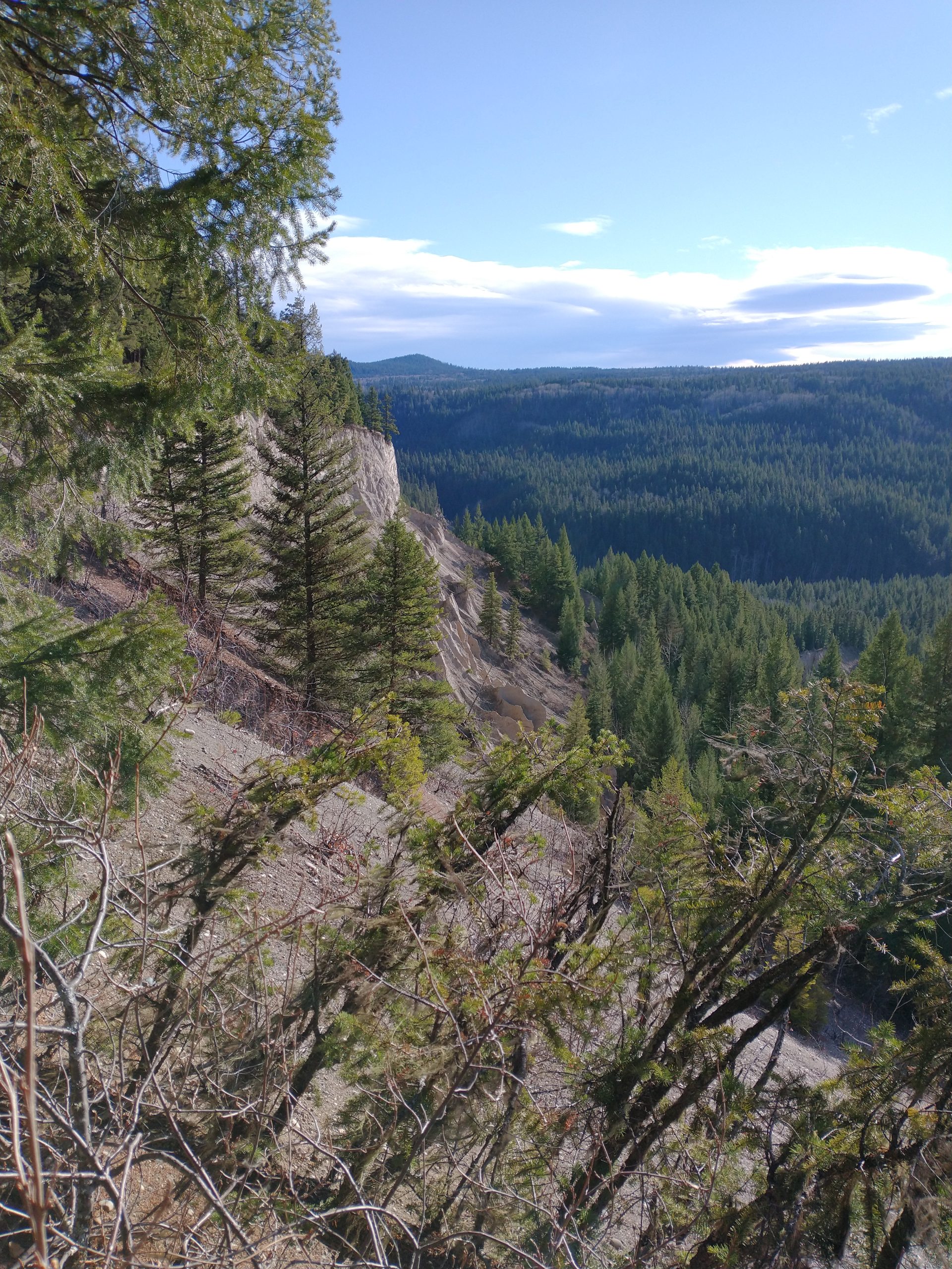
The Blackwater Canyon area, located near the Blackwater River Crossing Recreation Site south of Prince George, BC, offers beautiful views of the Blackwater River with options for short out-and-back hikes (around 3-4 km) or longer loops (like the 11 km loop), connecting to the Alexander Mackenzie Trail network, featuring river access, sandbars, and some overgrown sections, requiring caution for mud/ice but improved with new boardwalks.
One section of this area, called the “West Road Historic Trail”, connects the Blackwater Road and/or the Blackwater Canyon Trail to the Fraser River eastward. The rich history surrounding this area should not be underestimated, as this route was used by many as a major travel route between the Fraser River and the Pacific Ocean in the Bella Coola area.
The Trail system has many connection points, but ultimately it connects the Blackwater Road to the Fraser River at the confluence of the West Road River (aka Blackwater River) with the Fraser River. It is possible to access the east end of the trail by Jetboat at the confluence of the Fraser and Blackwater Rivers.
*Note: This trail is a work in progress and does not contain markers on every section of the route.
Difficulty level: Easy to Strenuous, depending on the routes taken, and the stats below are 1 way (not return)
Directions to the Trail are the same as the Blackwater Canyon Trail, which begins at the junction of the Blackwater Road and Blackwater River here, but it is also possible to start north of the Blackwater Trail where the Upper Blackwater East Loop trail connects on the ridge: here
Distance: 23.10 km
Elevation Gain: 1,241 m
Elevation Loss: 1,452 m
Elevation Max: 840 m
Elevation Min: 513 m
Photos (Credits: Darren Admas and Gerald Weich):


Videos:
Coming in 2026
From our 2025 Blackwater trail hike, we found the junction to the WRHT at 9:25 point below: