
| 3-day forecast 10-day forecast | Smoke forecast | Avy forecast | |||
| Photo | Trail Name | Hike Date | Trail Status | Comment | Submitted By |
 | ZigZag Ridge in Crescent Spur BC | 2026-Jan-24 | Snowshoe Packed | Snow Conditions were exceptional, the road is plowed all the way to the trailhead (just past the 2 km sign) and there is a pullout on the left to park right where the ribbon is visible at the trailhead. We added ribbons at the first section of trail when the existing ribbons stopped, in order to help others see where the trail goes. At this point the trail has ribbons all the way into the alpine | Mark Vejvoda |
| ZigZag Ridge in Crescent Spur BC | 2026-Jan-18 | Snowshoe Packed | Managed to make it to the Zigzag Ridge on a beautiful day with ideal conditions. I wouldn't say it was easy but it sure wasn't that tough. | ||
 | ZigZag Ridge in Crescent Spur BC | 2025-Aug-23 | Dry | It was a hot, bluebird day on ZigZag Ridge, the trail is in the best shape its ever been in, Travis and friends have cut a new trail at the start of the road leading into the ZigZag area right at the signs there are ribbons to the left. | Mark Vejvoda |
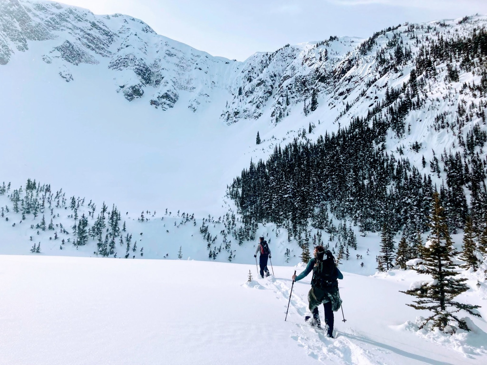
This trail is about 1.5 hours east of Prince George, BC, on Highway 16. In this adventure, we snowshoe up ZigZag Ridge for a 15 km round trip, near Prince George, BC. This is a very strenuous hike and is the hardest snowshoe that I have hiked in northern BC. The first 3 km are quite gentle, and then you get pounded to death for the next 4.5 km, climbing steep terrain, sliding in the snow, and pushing through deep snow pockets and air pockets. The hike is well worth the effort as you are rewarded with amazing views. There are a number of water sources most of the way up, and the cell signal was working for me for the entire hike. This hike is very challenging and is more of a route than a trail with periodic trail flagging markers. Only well-experienced hikers should attempt to hike this route, as it is very difficult and easy to get lost. The summit offers fantastic views toward Boulder Mt (east), Capra Glacier (southwest), and Erg Mt to the West. On a clear day, Mt Sir Alexander shows itself to the north, hiding in Kakwa Provincial Park.
GaiGPS of this hike from Aug 2025: here
Directions to trailhead: here
Difficulty: Very Strenuous
Distance: 17.8 km
Ascent: 1335 meters
Max elevation: 2099 meters
Moving Time: 6 hours 29 minutes
Total Time: 8 hours 36 minutes
Photos:


Videos:
Jan 2026:
August 2025:
December 2024:
December 2023:
September 2023:
March 2023:
Jan 2023:
March 2022: