
| 3-day forecast 10-day forecast | Smoke forecast | Avy forecast | |||
| Photo | Trail Name | Hike Date | Trail Status | Comment | Submitted By |
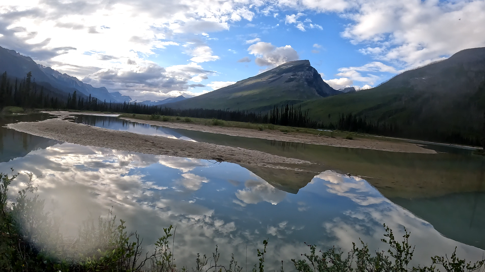
This trail is about a 3-hour drive east from Prince George, BC, into the Mt Robson Park area. In this adventure, I hiked the Moose River Trail with my hiking buddy, Gerald (see his channel here: Trekking with Taz). This is more of a ‘route’ than a trail as it becomes difficult to follow from time to time, disappearing into the river or the thick overgrown brush. There can be a lot of deadfall (especially in the burned-out areas from past wildfires) as well, since the route is less frequently traveled and has a lot of wildlife, including grizzlies. Water sources are abundant on this hike. There is no cell signal in the area, and given its remote location, it is highly recommended to carry an emergency communication device such as an InReach mini2, etc.
Directions to the trailhead: here
We have made several trips into this beautiful area which are documented below, but we should stress the fact that this area should be considered by only experienced backcountry hikers as it poses many real-world dangers, including deep/fast-flowing water crossings, grizzlies, thick brush, route finding, etc.
We have had communication with others who have used the information on this page and explored further into the glaciers and alpine of the Reef glacier and Snowbird Pass, which shows there is great potential for world-class adventures in this area.
July 2023 multi-day backpacking trip:
Day 1:
We hiked 19 km down the trail (one way), starting at 10:00 am. This is more of a ‘route’ than a trail, as it becomes difficult to follow from time to time, disappearing into the river or the thick overgrown brush. On the first day of our multi-day trip, we hiked 11 km to the falls, ate some lunch, and continued to the first horse camp at about 15.5 km. At this point, we decided to continue across the Resplendent as we had a lot of time before dark. It should be noted that this horse camp is a good location to camp, especially if the Resplendent Creek is too high to cross at the time of day that you arrive, the Glaciers melt less in the early morning. We set up camp where the Moose River Route continues northeast toward the Great Divide Trail on the flood plains beside the trail markers on a tree.
GaiGPS Track for day 1: here
Difficulty: Moderate
Distance: 18.9 km
Ascent: 389 meters
Max elevation: 1382 meters
Moving Time: 6 hours 41 minutes
Total Time: 8 hours 22 minutes
Day 2:
This video shows day 2 of a 5-day hike into the Moose River area from the flood plain where we camped the first day, up the Moose River Route to a very close connection point to the GDT north. We backtracked to the Resplendent River camp area on the first flood plains and proceeded north into the Resplendent Valley, where we set up camp on the very edge of the upper flood plains. The section from the day 1 camp to the GDT connection was about 8 km (16 return), and the hike north into the Resplendent Valley was about 4.5 km.
GaiGPS Track of Resplendent flood plain camp day 1 to GDT and back: here
Distance: 15.7 km
Ascent: 278 meters
Max elevation: 1474 meters
Moving Time: 5 hours 38 minutes
Total Time: 6 hours 52 minutes
Heading North toward our day 2 campsite from Resplendant Creek:
Distance: 4.49 km
Ascent: 48 meters
Max elevation: 1405 meters
Moving Time: 1 hour 24 minutes
Total Time: 1 hour 52 minutes
Day 3:
This adventure started with our recon (see the video back in June 2023) of the Moose River Route. Very little is documented online, but the area from a map viewpoint looks spectacular. This video shows day 3 of a 5-day hike into the Moose River area from the lower Resplendent Valley flood plain, where we camped the second day. The hike to the Reef Glacier Falls was mostly a bushwacking expedition, but very rewarding. The unique terrain and scenery were outstanding, and the area offers many options to explore.
Distance: 13.8 km
Ascent: 357 meters
Max elevation: 1682 meters
Moving Time: 6 hours 27 minutes
Total Time: 9 hours 0 minutes
Day 4-5:
This adventure started with our recon (see the video back in June 2023) of the Moose River Route. Very little is documented online, but the area from a map viewpoint looks spectacular. This video shows days 4-5 of a 5-day hike into the Moose River area from the lower Resplendent Valley flood plain, where we camped, to the Moose River Trailhead.
Resplendant Campsite to Moose River horse camp (Hi-Huna)
Distance: 8.17 km
Ascent: 10 meters
Max elevation: 1409 meters
Moving Time: 2 hours 32 minutes
Total Time: 3 hours 58 minutes
Hi-Huna horse camp to day 4 campsite on the riverside:
Distance: 9.65 km
Ascent: 25 meters
Max elevation: 1419 meters
Moving Time: 3 hours 27 minutes
Total Time: 4 hours 39 minutes
Day 4 campsite to Moose River Trailhead
Distance: 5.61 km
Ascent: 92 meters
Max elevation: 1306 meters
Moving Time: 1 hour 40 minutes
Total Time: 2 hours 0 minutes
June 2023 recon day hike (origin story of our experience in the Moose River area):
We hiked over 10 km down the trail (one way), starting at 2:20 pm. This is more of a ‘route’ than a trail, as it becomes difficult to follow from time to time, disappearing into the river or the thick overgrown brush. There can be a lot of deadfall (especially in the burned-out areas from past wildfires) as well, since the route is less frequently traveled and has a lot of wildlife, including grizzlies. Water sources are abundant on this hike. There is no cell signal in the area, and given its remote location, it is highly recommended to carry an emergency communication device such as an InReach mini2, etc.
Difficulty: Moderate
Distance: 22.4 km
Ascent: 425 meters
Max elevation: 1326 meters
Moving Time: 6 hours 25 minutes
Total Time: 6 hours 57 minutes
Photos:


Videos of this area:
November 2023 multi-day:
Tesla Prince: (July – summer and November winter trips playlist)
November 2023 multiday:
July 2023 multi-day:
June 2023 recon day hike (origin story of the Moose River Route for us):