
| 3-day forecast 10-day forecast | Smoke forecast | Avy forecast | |||
| Photo | Trail Name | Hike Date | Trail Status | Comment | Submitted By |
| Teapot Mountain in Summit Lake BC | 2026-May-04 | Variable | Drive to the trailhead was no problem with a minivan, the road just past the trailhead is snow covered and slushy but easy to turn around at the trailhead though a little muddy. The trail itself is mostly clear of snow/ice with a little bit near the start of the trail in the flat shady area, otherwise clear the rest of the way. | Mark Vejvoda | |
| Teapot Mountain in Summit Lake BC | 2026-Apr-23 | Variable | The majority of the trail is snow-free, except for the first 400m. You have to park 100m before the Crooked River bridge (for now). | ||
 | Teapot Mountain in Summit Lake BC | 2026-Mar-05 | Snow | The Caine Creek FSR is not plowed this winter so that would require 3.5 km one way packing trail to get to the trailhead. | Mark Vejvoda |
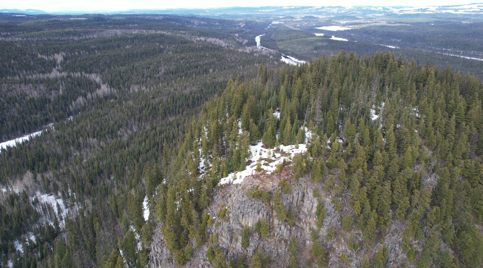
In this adventure, we hike up Teapot Mountain in Northern BC, 30 minutes north of Prince George, BC. This trail can be deceiving as it starts off with an easy ascent and quickly becomes steep with boulders and trees on parts of the trail (though the trail is well kept). The hike is short offering rock climbing opportunities on the south face of the summit (signs warn hikers of rock climbing) and superb views of Summit Lake to the South and Coffee Pot Mt / Sentinel Peak to the north. The only water available on this hike is near the trailhead as you cross the ‘Crooked River’ bridge right before the trailhead
GaiGPS track for the trail: here
GaiGPS track of the winter road hike to the trailhead, this section is unplowed in winter: here
Driving directions to the trailhead: here
Difficulty: Easy
Distance: 2.32 km
Ascent: 180 meters
Max elevation: 909 meters
Moving Time: 1 hour 25 minutes
Total Time: 2 hours 10 minutes
Photos:


Video:
November 2025:
Feb 2025:
Comments are closed.