
February 2023 marks the 35th anniversary of Mike Nash’s very first forays into Eskers Provincial Park, located west-northwest of the city of Prince George in North Central British Columbia, Canada. He celebrated this on Valentine’s Day 2023 with a ski tour from his original access point on the park’s south side. Just 900 metres (half a mile) along today’s access road is a small maintained parking area by a short gated road leading to a field. In an agreement with BC Parks, volunteers have been setting double cross-country ski tracks around the perimeter of this field for the past few winters. The field was privately-owned farmland when the park was established in 1988, and was only incorporated into the park a few years ago.
Early in 1988, some 50 members of the public were invited to participate in a fast-tracked planning process for the new park, which was a contribution to the community by local MLA Bruce Strachan, Minister of Environment from March 1987 to November 1989. The process, which would normally have taken at least a couple of years, was to be fully open to the public and was intended to be completed in a few months while Strachan still had responsibility for provincial parks.
A few gathered in the meeting room in the College of New Caledonia early in 1988 for that first planning meeting had any ‘boots on the ground’ knowledge of the proposed park, including park staff. However, one of the precious things that they received that first evening was a large-sized blueprint copy of a large scale contour map that had been commissioned a few weeks earlier for the planning process. As a lifelong aficionado of maps, Mike spent many hours examining this one before deciding to thoroughly familiarise himself with the park on the ground as soon as he could. It was a heavy snow winter that year, which would provide for good travel using mountain touring skis, utilizing lakes and open ridges as much as possible. This was long before the mountain pine beetle caused so much deadfall in the park that, today, it seriously impedes bushwhack travel.
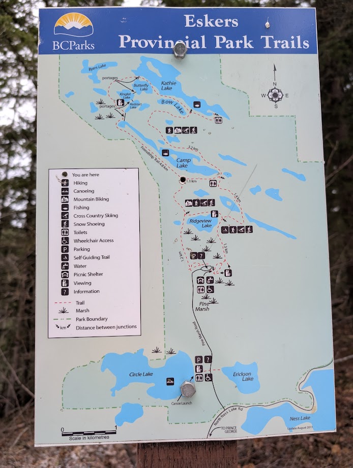
The only road access into the park at that time was a short one-kilometre stretch to the aforementioned farmer’s field, and consequently, Mike used this as his main staging place for most of my weekend explorations between February 6 and March 5, 1998. He also began from Murch Lake on the park’s north side on at least one occasion, when fellow Caledonia Ramblers Hiking Club members Dave King and Uta Schuler accompanied him. Mike kept detailed notes of my travels on the large map, and I filled a binder with photographs taken throughout the park, with locations and camera directions indicated on map segment copies. At the end of this four week period, my tally showed that I had visited a grand total of 58 different lakes and ponds, many of them more than once. These features are predominantly glacial kettles created by residual ice blocks left behind by the last glaciation, interspersed with the eponymous eskers.
Mike travelled on backcountry skis equipped with metal edges and climbing skins in order to cope with the steep ascents and descents of the many esker ridges, and to aid with the bushwhacking. Travel was easier on the south-facing slopes, which were drier and more open, but correspondingly more difficult on the densely-treed north-facing slopes. In all, he covered 72 kilometres (45 miles) and 1,692 vertical metres (5,550 vertical feet), visiting almost all of the park as it was initially configured. Ten years later, the park was doubled in size in a northwesterly direction as part of the BC government’s protected area strategy to protect some 16 per cent of the province’s land base. There are still no formal trails in the northern end of the park, although there is likely some fishing access at Taginchil Lake.
One can simply track-ski around the field, or you can strike out northeast from its farthest end, making one’s own tracks through a myriad of beaver-dammed swamps and ponds as I did on this latest trip. This part of the park has much flatter and gentler ground than most of the rest of the park, with its steep esker ridges, but it is also swampy, meaning winter is the best time to explore it. On a clear, winter day, the field, swamps and ponds are a veritable sun trap to rival anything in the Caribbean (OK, maybe that’s a bit of a stretch for some). In the spring, you can usually see black bears feeding in the field, attracted by the newly emerging vegetation. The field is, however, being replanted to restore native vegetative cover, so today’s generous winter sun and spring wildlife viewing will diminish over time. The snow on this occasion was crusted and supported my weight with little ski penetration. When stepping off the skis for a halfway refreshment break, however, he went in thigh deep. It would have been challenging to hike out without skis or snowshoes, so one needs to be prepared for equipment failure in these conditions.
Photos:


