
| 3-day forecast 10-day forecast | Smoke forecast | Avy forecast | |||
| Photo | Trail Name | Hike Date | Trail Status | Comment | Submitted By |
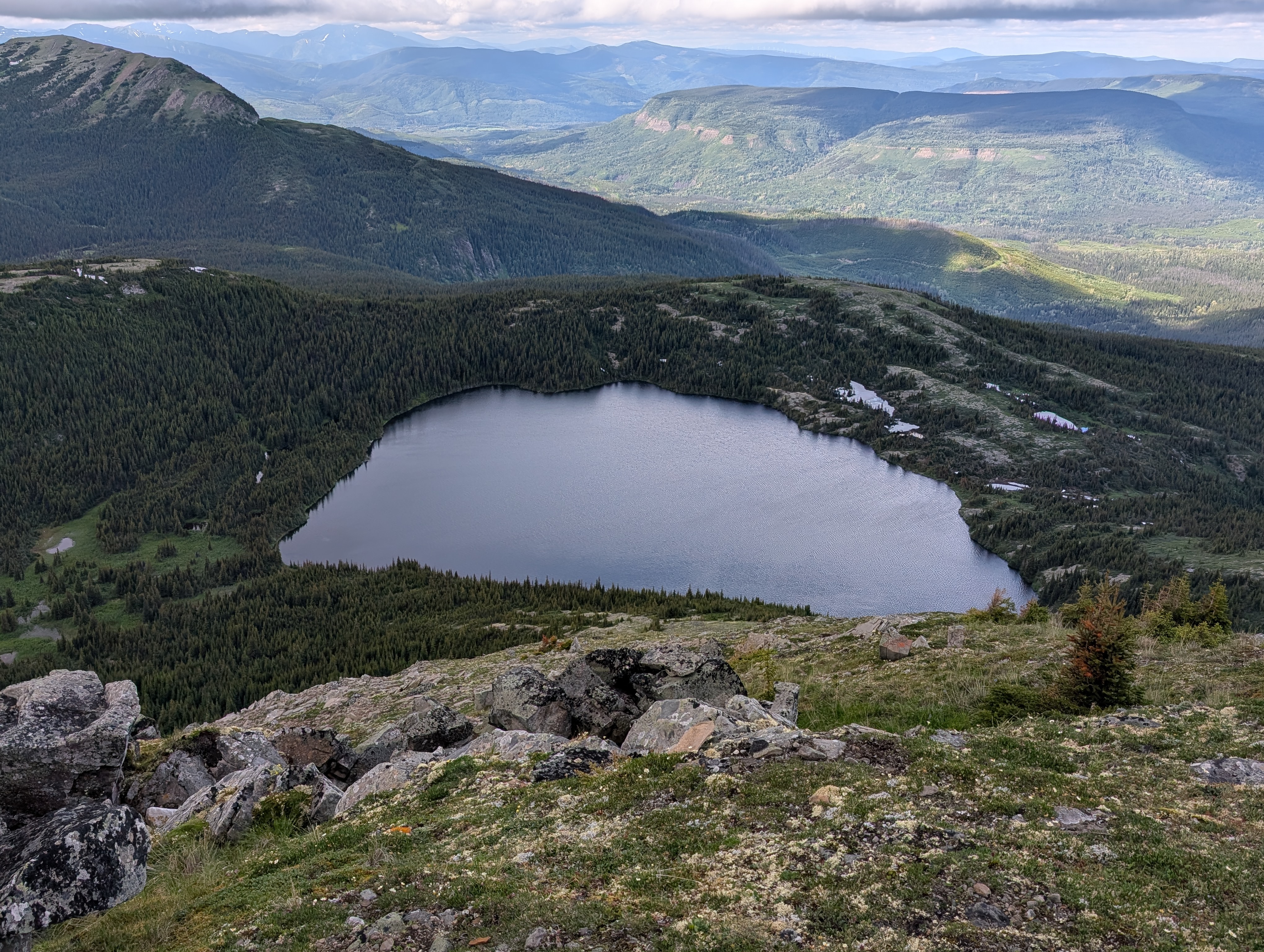
 | Le Hudette Lakes near Chetwynd BC | 2026-Jul-01 | Variable | Trail is quite wet especially at the start where its virtually impossible to not get soaked feet due to the depth and length of the water. There were a few small sections of snow but nothing to hinder hiking all over the alpine. | Mark Vejvoda |
Description:
Warning: This is not a developed trail, but rather a route. It is only suitable for strong, experienced hikers with good route finding skills.
This route follows a seismic line into the alpine, to two beautiful alpine lakes and a couple alpine tarns. It is a short, uphill trek into the alpine. Once in the alpine, there are lots of opportunities for alpine travel such as ridge walking, hiking to various summits, etc.
For the most up-to-date information, check out the Chetwynd Outdoors Society website
Difficulty level: Moderate
Directions to the Trail: here
Stats:
Distance: 13.15 km
Elevation Gain: 685 m
Elevation Loss: 678 m
Elevation Max: 1,783 m
Elevation Min: 1,531 m
History:
Comming soon..
Photos:


Videos:
July 2026